Bereich "Identifikation"
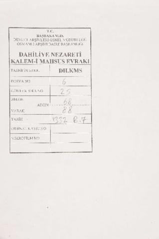
Signatur
Titel
Datum/Laufzeit
- 1914-06-01 (Anlage)
Erschließungsstufe
Umfang und Medium
1 item, 68 pages
Bereich "Kontext"
Name des Bestandsbildners
Bestandsgeschichte
Abgebende Stelle
Bereich "Inhalt und innere Ordnung"
Eingrenzung und Inhalt
In order to conclude the topographical map of Palestine, the British started mapping activities at some places on the Egyptian border, and Gaza is the first place. 1-2, 4, 8, 12, 15, 19: no signature; 3: Kudüs Mutasarrııfı Macid; 5: signed by Sadrazam Mehmed Said; 6: signed by Akka Kaymakamı [Tevkim]; 7: signed by Medine-i Münevvere Muhafaza Kumandanı Mirliva [illegible]; 9: signed by Harbiye Nazırı ve Erkan-ı Harbiye-i Osmaniye Reisi adına Müsteşar Suat; 10: Fransızca evrak; 13: signed by Şam Sekizinci Kol ordu Kumandanı adına İhsan Bey; 14: signed by Kudüs Mutasarrıf Ahmed Macid; 16: signed by Harbiye Nazırı Enver; 17, 20: signed by Mutasarrıf Macid; 18, and an other page: signed by İngiliz Heyet-i Feniiyesi'nin tedkik-i icraatine memur Yüzbaşı Hüseyin.
Bewertung, Vernichtung und Terminierung
Zuwächse
Ordnung und Klassifikation
Bedingungen des Zugriffs- und Benutzungsbereichs
Benutzungsbedingungen
Reproduktionsbedingungen
In der Verzeichnungseinheit enthaltene Sprache
Französisch
Englisch
Osmanisch