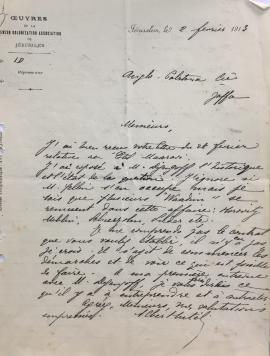
- JM-CZA/Institutions/4/L51/14/Selected01
- Unità documentaria
- 1913-02-02
Parte diArchives of organizations and bodies preserved by the Central Zionist Archives
Parte diArchives of organizations and bodies preserved by the Central Zionist Archives

Demolition plan for the Mughrabi quarter, June 10th 1967
Handwritten plan with five signatures.

Note from Yael Vered to Yosef Tekoah (Ministry of Foreign Affairs), June 9th 1967
"Explosion by the Western Wall", Davar, issue of September 1st, 1927, p. 1
Histadrut (H)

Sheet XVII, in: Map of Western Palestine in 26 sheets from the surveys conducted for the Committee of the Palestine Exploration Fund [cartographic material] / by Lieutenants C.R. Conder and H.H. Kitchener R.E. during the years 1872-1877, [maps drawn in May 1878], London, Photozincographed and Printed for the Committee of the Palestine Exploration Fund at the Ordnance Survey Office Southampton, 1880.
In particular, this sheet shows Jerusalem and its surroundings.
A copy of this map is preserved in the Laor Collection at the National Library of Israel and its digitalization is available online (accessed 2022-01-21): https://www.nli.org.il/en/maps/NNL_MAPS_JER002368494/NLI#$FL50537899
Claude Reignier Conder (CRC)
Jerusalem Jordan regional planning proposals
This document consists in 2 maps.
A copy of this document is preserved at the National Library of Israel and its description is available online (accessed 2023-05-05): https://www.nli.org.il/en/maps/NNL_MAPS_JER990023670330205171/NLI
Henry Kendall (HK)
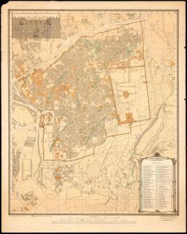
Jerusalem. The Old City (1945)
"Jerusalem. The Old City", map compiled under the direction of Frederick John Salmon, revised from information supplied by Department of Antiquities, 1945, second edition, printed by the Survey of Israel, July 1954.
A copy of this map is preserved in the Laor Collection at the National Library of Israel and its digitalization is available online (accessed 2022-01-21): https://www.nli.org.il/en/maps/NNL_MAPS_JER002480128/NLI#$FL83894268
Frederick John Salmon (FJS)

Photomontage in tribute to the “Kotel Order”
Photomontage ordered by the "Kotel Order" to Lea Majaro-Mintz.
Valérie Nivelon and Marion Lefèvre, "Jérusalem 1967: la destruction du quartier des Maghrébins", RFI, June 10th 2017, accessed online on 2023-05-22: https://www.rfi.fr/fr/moyen-orient/20170609-jerusalem-1967-destruction-quartier-maghrebins
Lea Majaro-Mintz (LMM)

Account books of the waqf Abou Mediene: balance sheet for the year H. 1288
Jerusalem Awqâf Administration (KEAM)

The provenance of this postcard published in Israel and featuring a photograph of Jerusalem is not known.
It features a photograph of Jerusalem taken between June 1967 and June 1969, and shows the Dar Abu Saud in particular.