
- US-LoC/LC-M32-52532-x
- Item
- 1927-07-01
Part of The Matson Photograph (G. Eric and Edith) Collection
The earthquake of July 11, 1927 in Jerusalem
72 results directly related Exclude narrower terms
Part of The Matson Photograph (G. Eric and Edith) Collection
The earthquake of July 11, 1927 in Jerusalem

Jerusalem (El-Kouds). Jews' wailing place
Part of The Matson Photograph (G. Eric and Edith) Collection
The Western Wall circa 1910
Jerusalem. Temple area from the south, Ophel in the foreground
Part of The Matson Photograph (G. Eric and Edith) Collection
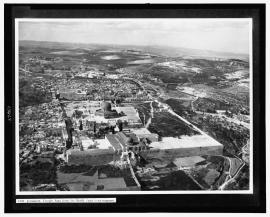
Aerial view of the Maghreb district towards the north
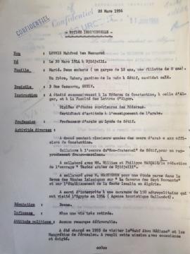
Individual information form concerning Hajj Lounis, March 28, 1956
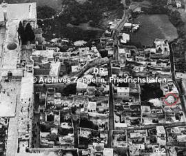
Aerial photograph of the Maghreb district taken by the Zeppelin
It is possible that this photograph is part of a complete file but we have no additional information to be sure.
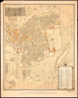
Jerusalem. The Old City (1945)
"Jerusalem. The Old City", map compiled under the direction of Frederick John Salmon, revised from information supplied by Department of Antiquities, 1945, second edition, printed by the Survey of Israel, July 1954.
A copy of this map is preserved in the Laor Collection at the National Library of Israel and its digitalization is available online (accessed 2022-01-21): https://www.nli.org.il/en/maps/NNL_MAPS_JER002480128/NLI#$FL83894268
Frederick John Salmon (FJS)
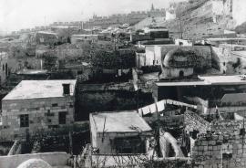
Photograph of the Mughrabi quarter in the 1950's
Part of EBAF's Photographic Collection
This photograph shows a view of the Mughrabi quarter toward the south.
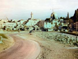
Photograph of the southern edge of the Mughrabi quarter in January 1964
Part of EBAF's Photographic Collection