
- RNYA/VLR/ph20180214/IMG6201
- Item
- 2018-02-14
Part of Vincent Lemire's records
Part of Vincent Lemire's records
Part of Vincent Lemire's records
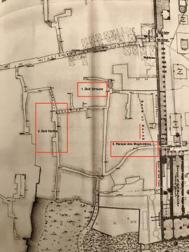
Map locating the 3 archeological sites excavated since 2005 on the mughrabi quarter area
Part of Vincent Lemire's records

A documentary archipelago: extract from the research notebook "Mughrabi quarter"
Part of Vincent Lemire's records
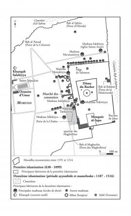
Map representing the Islamic foundations in Jerusalem at the Ayyubid and Mamluk periods, 1187-1516
Part of Dario Ingiusto's records
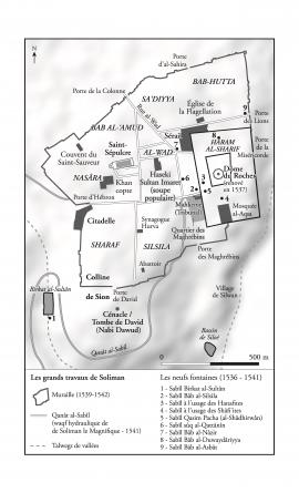
Map representing Jerusalem at the Ottoman period, 1516-1917
Part of Dario Ingiusto's records
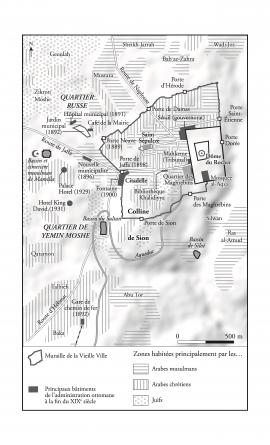
Map representing Jerusalem in the early 1930's
Part of Dario Ingiusto's records
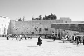
Photograph of the Western Wall Plaza
Part of Vincent Lemire's records

View of the excavation of Beit Haliba
Photograph publicated in : Emek Shaveh, “Beit Haliba” and the Givati Parking Lot Archeological Excavations and their Effect on the Status Quo in the Old City of Jerusalem and in Silwan", September 9, 2013: https://emekshaveh.org/en/haliba/
Part of International Committee of the Red Cross, General Departments