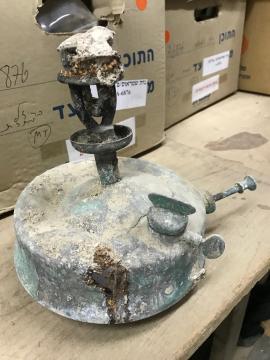
Photograph of a kerosene stove
- RNYA/VLR/ph20180214/IMG6192
- Item
- 2018-02-14
جزء منVincent Lemire's records
Photograph of a kerosene stove
جزء منVincent Lemire's records

جزء منVincent Lemire's records

جزء منVincent Lemire's records
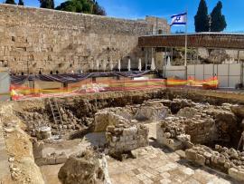
Photograph of the excavation site of the Mughrabi ramp
جزء منVincent Lemire's records

Map "Waqf Abu Madyan" by Louis Massignon
This map by Louis Massignon is published in the following article:
Louis Massignon, "Documents sur certains waqfs des lieux saints de l'Islam : Principalement sur le waqf Tamini à Hébron et sur le waqf Hancénien Abu Madyan à Jérusalem", Revue des Études Islamiques, vol. XIX, 1951, p. 73-120.
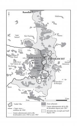
Map representing Jerusalem in 1967
جزء منDario Ingiusto's records
Map created between 2014 and 2018, and modified in 2021.

View of the excavation of Beit Haliba
Photograph publicated in : Emek Shaveh, “Beit Haliba” and the Givati Parking Lot Archeological Excavations and their Effect on the Status Quo in the Old City of Jerusalem and in Silwan", September 9, 2013: https://emekshaveh.org/en/haliba/

Photomontage in tribute to the “Kotel Order”
Photomontage ordered by the "Kotel Order" to Lea Majaro-Mintz.
Valérie Nivelon and Marion Lefèvre, "Jérusalem 1967: la destruction du quartier des Maghrébins", RFI, June 10th 2017, accessed online on 2023-05-22: https://www.rfi.fr/fr/moyen-orient/20170609-jerusalem-1967-destruction-quartier-maghrebins
Lea Majaro-Mintz (LMM)

Jerusalem Municipality (IY)