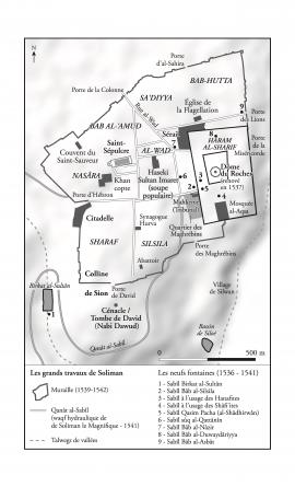
Map representing Jerusalem at the Ottoman period, 1516-1917
- RNYA/DI/map1516-1917
- Τεκμήριο
- 2014-2018
Μέρος τουDario Ingiusto's records
102 αποτελέσματα με ψηφιακά αντικείμενα Προβολή αποτελεσμάτων με ψηφιακά αντικείμενα
Map representing Jerusalem at the Ottoman period, 1516-1917
Μέρος τουDario Ingiusto's records
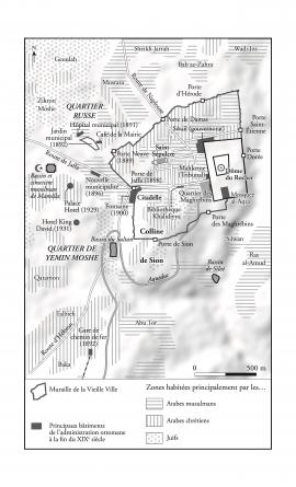
Map representing Jerusalem in the early 1930's
Μέρος τουDario Ingiusto's records

Jerusalem Municipality Archives, Box n° 5994
The files held in this box are related to the management and the development of the quarters of Jerusalem.
Jerusalem Municipality (IY)

Undated note listing the ten steps of the compensation procedure put in place by the municipality
This note was written by Meron Benvenisti, in charge of East Jerusalem after its annexation.
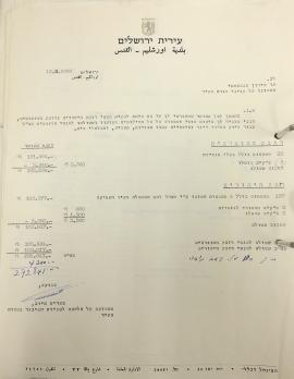

Jerusalem Municipality (IY)

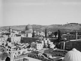
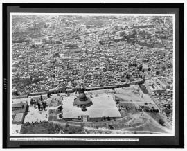
The Temple area. Jerusalem. The Dome of the Rock and the western Temple wall
Μέρος τουThe Matson Photograph (G. Eric and Edith) Collection
View of the Maghreb district to the northeast, early 1920s
![Zeppelin [i.e., Graf Zeppelin] over Jerusalem](/uploads/r/library-of-congress-loc/1/5/3/1534b234d6b912935fd161943a0095ade6d6081305afd4901fbe3e30e089de4c/USLOC-LC-M32-13841_142.jpg)
Zeppelin [i.e., Graf Zeppelin] over Jerusalem
Μέρος τουThe Matson Photograph (G. Eric and Edith) Collection
Μέρος τουThe Matson Photograph (G. Eric and Edith) Collection
Aerial view of the Maghreb district towards the west