- RNYA/DI
- Record group
- 2014-2021
These maps were commissioned to Dario Ingiusto for the purpose of the Open Jerusalem project. They represent Jerusalem at different stages of its evolution, from 1187 to 1967.
Dario Ingiusto (DI)
4 results with digital objects Show results with digital objects
These maps were commissioned to Dario Ingiusto for the purpose of the Open Jerusalem project. They represent Jerusalem at different stages of its evolution, from 1187 to 1967.
Dario Ingiusto (DI)
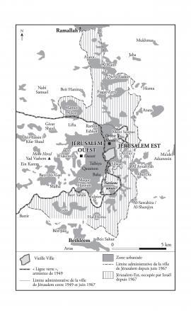
Map representing Jerusalem in 1967
Part of Dario Ingiusto's records
Map created between 2014 and 2018, and modified in 2021.
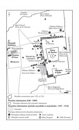
Map representing the Islamic foundations in Jerusalem at the Ayyubid and Mamluk periods, 1187-1516
Part of Dario Ingiusto's records
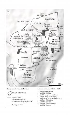
Map representing Jerusalem at the Ottoman period, 1516-1917
Part of Dario Ingiusto's records
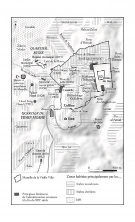
Map representing Jerusalem in the early 1930's
Part of Dario Ingiusto's records